# Indexed Point Cloud
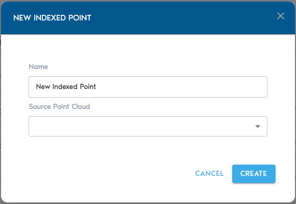
The Indexed Point Cloud entity is the result of applying the project’s spatial index to a raw Point Cloud entity. Indexed Point Clouds can be visualized and combined with other forms of spatial data.Once you select “Indexed Points” from the “Add Object” button, you will see the following options:
[](https://help.mystart.com/uploads/images/gallery/2025-03/w0kimage.png)
Item Name
A readable name for the new entity
Source Mesh
Shows a lists of available raw Point Cloud entities. From this list, you can select which raw Point Cloud will be used to create the Indexed Point Cloud.
Click on “Create” to begin the indexing process. You can track the upload operation from the “Pending” section in the project’s page.Once the processing is complete, you can view the new entity by clicking on the “View” button in the entity’s row inside the Catalog section for the project. Alternatively, you may create a View entity that uses the newly created entity as a source dataset.